El Cajon Sinkhole
El Cajon Bay Underwater Sinkhole
GPS: 45.08629, -83.31786,
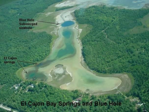
Karst geology features are prominent in and around the El Cajon Bay of Lake Huron. Earth cracks are common around the bedrock north and west rim of the bay. A large sinkhole in the bay is the outlet of an underground stream. Water discharge from the outlet empties into Lake Huron and, due to the constant flow and warmer temperature of water, the sinkhole never freezes over. When water levels in Lake Huron are high, the El Cajon sinkhole is submerged, but still visible on aerial photos. During low water levels like recent years, one can walk up to the edge of the sinkhole. The sinkhole discharge water has a different chemical composition than surface water of the bay and has a noticeable sulfur-like aroma. The property has excellent examples of untouched northern ferns and is a stronghold for the State’s wildflower, the Dwarf Lake Iris, which blooms in mid-May.
More information is available at the Alpena Visitor Welcome Center located at 420 N. Second Ave, Alpena, MI 49707


 420 N. 2nd Ave. Alpena, MI 49707
 989-340-2288